
From Statia to Saba is just a few hours sail. While we didn’t have the luxury of picking a perfect window, because COVID, it’s generally downwind, and we sailed reasonably comfortably with just a poled-out genoa. Anchoring is discouraged, though the island descends so steeply into the sea that the prospect would be difficult anyway. The government provides mooring balls in two places. The first is directly outside the Fort Bay harbor, but as we sailed by and watched all the little boats violently shaking, we decided to keep moving.


Instead, we rounded the corner to Ladder Bay, and grabbed the first ball that didn’t have “Dive Only” written on it. This turned out to be a dive ball as well, and we would eventually move a few hundred feet further north. Being around the corner puts you out of view of the rest of the island, not to mention out of cell phone service. (Our Chippie cards from Statia still worked here; it’s always nice when that item isn’t on the arrival checklist). It’s been a while since we’ve been that far from other boaters, aside from on passages, and the isolation was a welcome change. Of course, it felt less welcome when our dinghy engine stalled on the way to check-in; he’s never done well with big choppy waves.
Ladder bay is a stunningly beautiful cliffside anchorage, and after our first day there, it was flat and comfortable, which we hear is unusual. It’s named for the original route up to the town of The Bottom, a series of steps carved into the stone in the second picture below. The old customs house marks roughly the half-way point.


Of course, even the paved modern route, from Fort Bay, has a lot of vertical distance to cover. After checking in at the dockside office, we started to walk up, but quickly realized that this was a brutal thing to do to ourselves in the hot sun and umbrella-inverting wind. Fortunately, hitchhiking is considered totally acceptable here. (And the majority of the island is already fully vaccinated, so it’s also quite safe.)

Up the hill is the town of The Bottom, which immediately presents a striking contrast to Oranjsted in neighboring Statia. While both have some older buildings, Saba is remarkably uniform, with most buildings painted white, trimmed in green and roofed in red.


In an odd bit of COVID logistics, we’d had to schedule an exit test for our first day here. We’d arrived a bit early and the office was closed, so we headed to a cafe, only to find a painted-on closed sign (which gets covered when the door is open.) In fact, most things were closed, for Good Friday. But the Chinese restaurant was open and willing to sell us waiting-beers.


Our first-ever rapid tests came up negative, as expected, and we were left wondering what to do in the closed-down town. The obvious answer is always to explore, so we hitched another ride up to Windwardside and walked around. Wandering towards a (closed) museum brought us to a small park, where we discovered bunnies. Easter-appropriate!


We also ran into a lady named Anne, who offered us some shelter from a passing rain shower. Anne has been visiting Saba for years, using the old rectory above the park as something of a base for her backpacking trips around the world. Like many of us, her plans were derailed by COVID and she’s spent longer in one place than she’d planned. We were impressed with her adventurous spirit and inspired by her stories and energy. May we age with as much grace!


Windwardside has a lot of the same look as The Bottom, albeit with somewhat more fog. Or maybe I should call it cloud, as you get the feeling that the clouds are rolling down the mountain. This is apparently where the island’s action is, though there wasn’t much open on our first day there. So we walked around and gaped at all the tiny graveyards and well-maintained children’s parks.


We did find one bar open, and while they weren’t serving food, they were able to get us in touch with a taxi driver who would bring us back to Fort Bay. We arrived at sea level to find The Deep End’s kitchen had just closed, but they agreed to make us a couple of burgers anyway. Jazz loved the view from their bathroom.


Back at the boat we found the wind and current fighting and the mooring ball slapping against our hull, and Jazz decided that remembering the moment was more important than helping fix the problem. :-

In the morning, we moved off of the dive ball, and then headed into town to meet Cyril, the taxi driver from the previous day who had agreed to play tour guide for us.

We made a couple of stops to look down at The Bottom as we drove along the Road That Could Not Be Built to Windwardside. Apparently locals had asked the Dutch government to build a road, and been told that it was impossible. So they hired their own expert, who went ahead and did it anyway.


Of course, the first stop had to be for coffee. But the bakery-cafe also sold Easter-themed cookies, which we just couldn’t resist taking home.

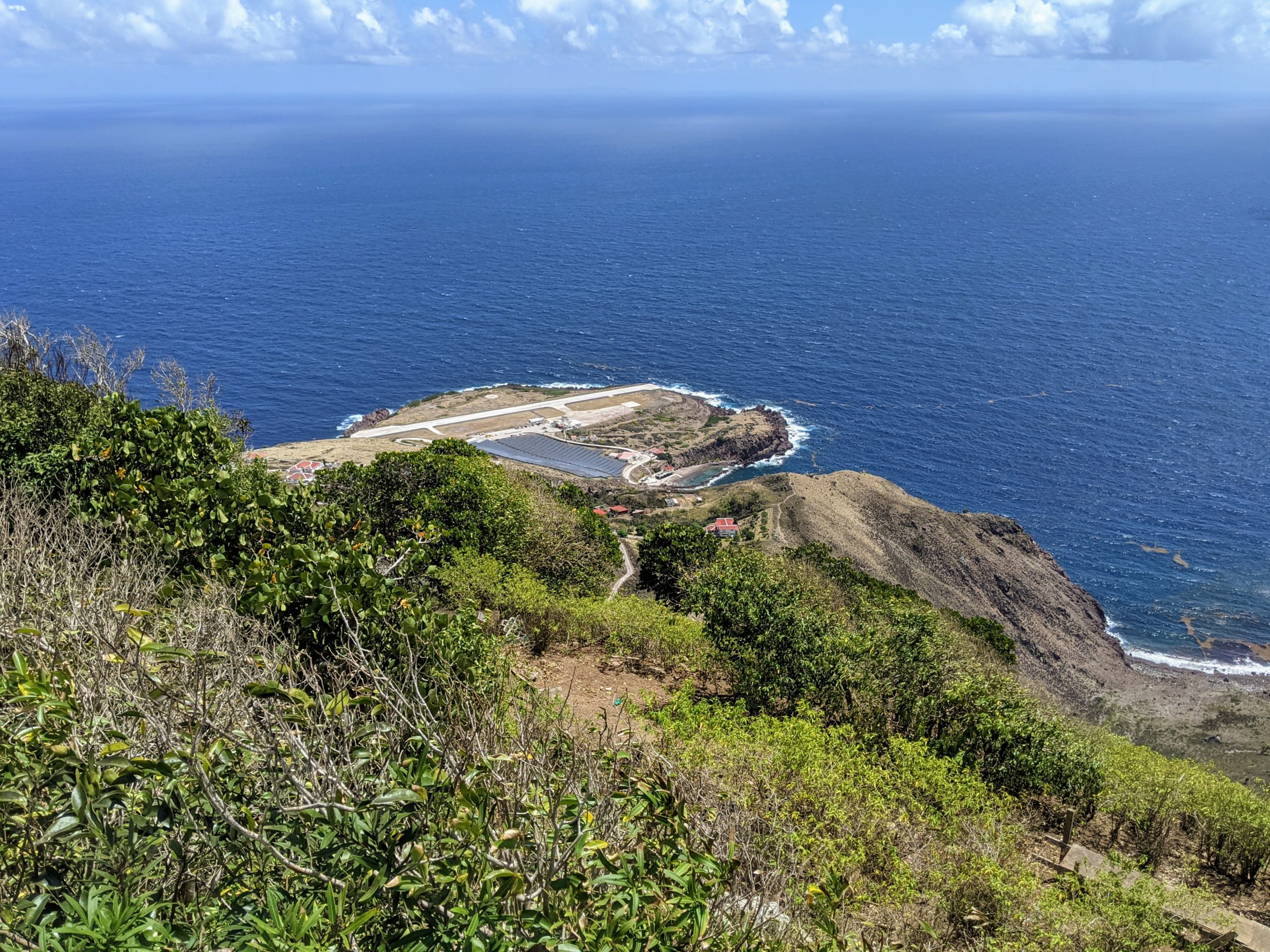
Now fed and caffeinated, we continued down the other side of the island to Cove Bay, stopping for a couple of photos. Cove Bay is right by the (also impossible) airport, and features a rock-enclosed swimming area that’s apparently popular on the weekends.


But the in-the-know locals favor some slightly more secluded tidal pools. Apparently this is where Cyril learned to swim, though Jazz, with her recent sea urchin experience, found the hoards of urchins made the pools feel somewhat less than inviting.


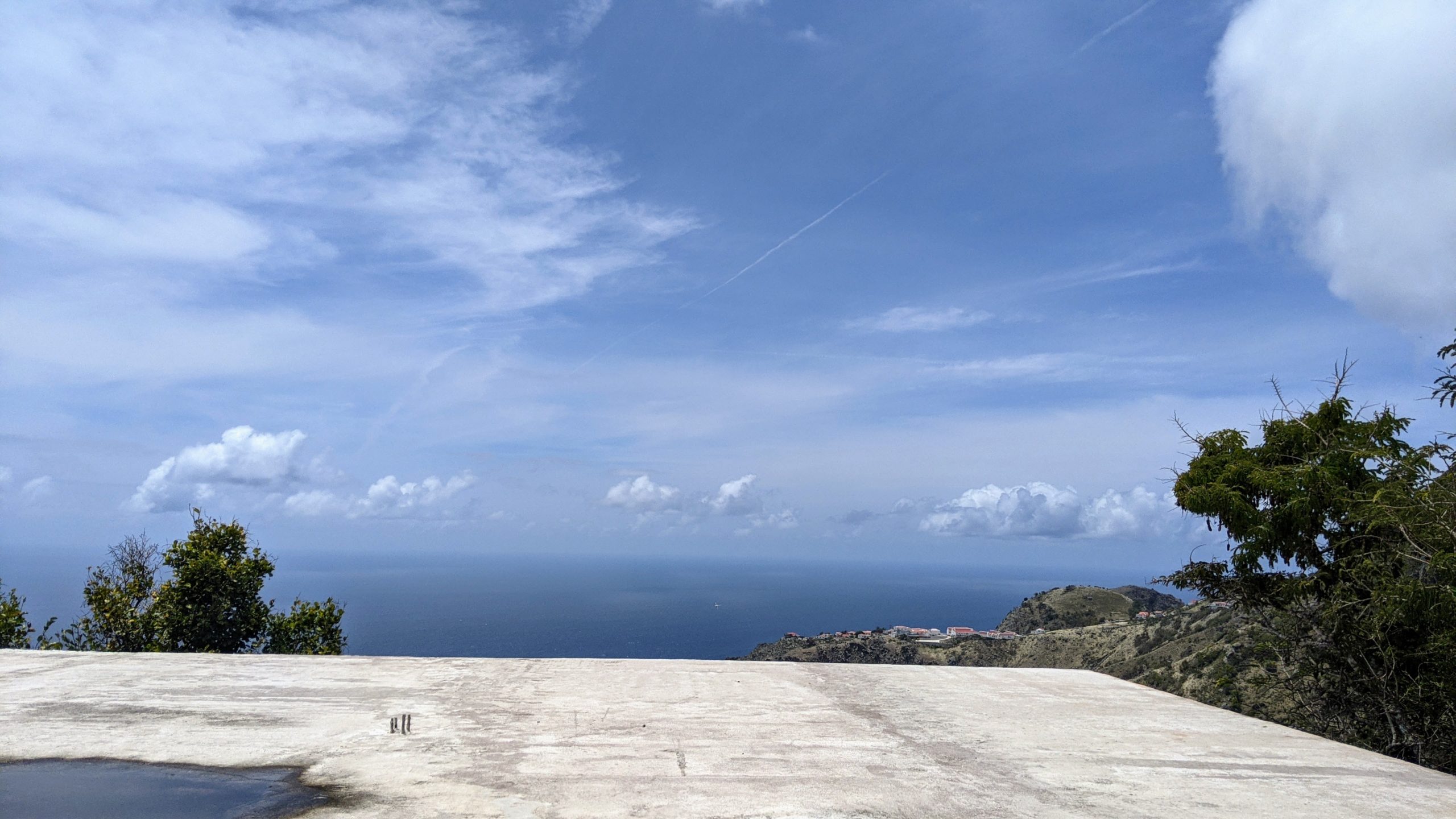
Then, back up the hill to see some more vistas, including a stunning view from the roof of a somewhat eccentric man’s work-in-progress house. See also, the whale in the mountain over The Bottom.


We stopped again in Windwardside to walk around a bit more, and happened by a tiny quarantine hotel. One of the guests steppe out to the balcony for a socially-distanced chat, and we were struck by how weird it’s become to interact with other humans. We also managed to run into Anne again; lovely lady.


Back at the boat, the swell was beginning to settle down, and we found ourselves alone with a lovely sunset.

The next day we went diving. The dive boat came and picked us up from Villa, and had rinse water on board for before they dropped us off again. The diving was lovely and easy, and we saw reef sharks and impressively massive turtles. We were a little sad that diving without a guide isn’t allowed, because with so little current it would have been safe and easy. But that lack of current is likely also why the water wasn’t as clear as Statia’s. Anyway, these were deep dives so we left the camera at home, and all I can offer for the day is Captain leading the charge to watch the sunset.

Besides diving, the other Thing To Do in Saba is to hike Mt. Scenery. So we set off to do just that, starting with a hitch-hike from the dinghy dock up to The Bottom Bean cafe.


We’d planned to hitch a second ride to the trailhead in Windwardside, but the cafe owners suggested we take the Crispeen Track to make a loop of it. That starts just barely above the bottom, and winds gradually upward through the edges of people’s gardens.


As you start to get higher up, the plants change, gradually becoming less deciduous and more jungle. We had some fun with the sheer size of the elephant ear leaves; we’ve seen them before, but never as consistently enormous.


Eventually you end up back at the Mount Scenery trail, which, as advertised, is mostly steps. And a surprising number of feral chickens.


Near the top, a turnoff offers an alternate route down along the Elfin Forest Trail. Even a few feet into the trail, it’s clear that this is a different ecosystem. A lush tangle of ferns and vines makes even the light feel green. Also it’s damp.


We turned back to the main trail and continued upward, despite Jazz’s protests that she was done with all the going up (see the third photo, where she’s pointing at a distant staircase). We passed the tops of the Mountain Mahogany trees into yet another ecosystem. This one had shorter flowering trees, tall radio towers, and sweeping views of the towns and surrounding islands, which came into view and receded again as the clouds came and went. Also, some sign designer definitely did not understand a certain double entendre.


On the way back down the steep, slightly slippery steps, we got to watch the transformation in reverse. Clouds, giant elephant ears, and plentiful epiphytes gradually gave way to a drier, temperate forest. By the end, it felt much more like what we’d seen on Statia, even down to the abundant hermit crabs.


Also familiar from Statia, and most other islands: vehicles with prominent names and slogans. Forward ever backwards never! (Which, if you parse it with the line break in the picture, is… just odd.)


Even having done it several times, it felt weird to round the corner in the dinghy, with the last traces of other people disappearing before Villa came into view. Note also the purple-sand beach, which apparently comes and goes in some combination of randomness and seasonality.


It was weird to leave an island so quickly, after having gotten used to spending weeks or months anywhere we stopped. But we’d made appointments to get our vaccines in St Croix, so we had to leave Saba behind. And we did so with some sadness: this was one of our favorite islands so far, and if someone would build a decent brewery, I could see us staying for a while. Definitely on land, though: that trip from the anchorage to the dinghy dock is just punishing.

One comment